VISIT US
Maps and Walks
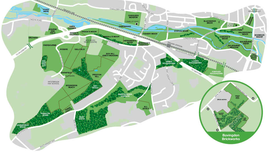
Please note that this section is being updated. The estate map below shows two walk routes that are no longer current (the green and orange routes). A new map showing four new walk routes will be uploaded as soon as it is available. Blue and red walks are still current and these two maps are free to download below. If you enjoy your walk, please consider making a small donation to help us care for the land. We ask that you observe the countryside code at all times and respect the animals and fellow walkers on your travels.
Blue Walk
This is an easy walk along the valley floor.Length: approx. 4.5 – 6km (2.8 – 3.7 miles), approx. 1.5 – 2 hours.
Download Walk
Red Walk
A walk with several steep hills suitable for the more agile. Approx. 6km (3.5 miles), 2 – 3 hours.
Download Walk
Queen's Green Canopy and King's Coronation
Box Moor Trust has planted commemorative trees, click to discover their location
See Details
Westbrook Hay SANG Walk Map
Four new walk routes ranging from 600m to 4.8km - all easily signposted
Download Walk